Selside Shenanigans.

This part of Ribblesdale is always a good place to pull in and have a little wander. Good weather is an advantage though as the area really is open to the elements. Pen-y-Ghent stands across the Dale and Ingleborough is only a few miles behind you so the wind just to tears across the dividing moors on most days of the year. Pen-y-Ghent is known as "Hill of the wind" and it's not called that for nothing! The only problem can be parking up as this track is popular with cavers and, at times, their mini-buses turn up in droves. Fortunately mine was the only car there.

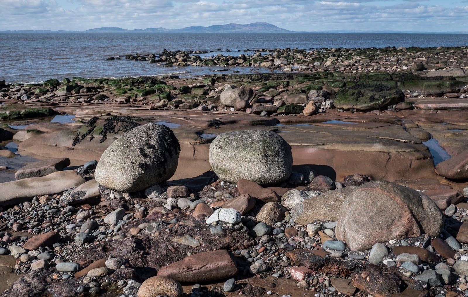
There's some interesting limestone pavements in the vicinity of Seaside which are always worth a visit and the path I used to go up to Alun Pot is dry and easy to follow. It sort of loses its way the further up you get but I should imagine that, on a nice dry and clear day, you could get yourself to the top of Ingleborough. Your feet might be wet by the time you top out but I should imagine its possible. Obviously the pothole is fenced and walled off as it has a depth of 341ft (104mtrs) and its entrance is hidden in the trees. I suppose its more for the local sheep than for us humans but having said that, limestone can be very greasy when wet so just a  slip could be disastrous.

Today was a quiet day and I didn't encounter a soul until I was well on my way back. I then passed a sole caver who was heading up to Alum Pot with full gear on. Caving is not a pastime I have ever remotely considered, possibly because I could never fit through all the narrow passageways which seem to be an integral part of the overall experience but also I hate dark spaces and feeling trapped.

As well as being rewarding, pot holing can also be very dangerous if the water levels are rising which they can do that in minutes in the Dales. A few years ago the bodies of the 33-year-old man from Darlington and the 28-year-old woman from the Bradford area were found in Alum Pot, the pair had become trapped in the cave following downpours on the surrounding fells.

One intriguing feature was a ruined barn which was situated right on top of the moorland above Selside; talk about being exposed. It did make for a great photo though as it had the full bulk of Pen-y-Ghent as a backdrop. Looking across the dale towards Pen-y Ghent brought back memories of me climbing it many years ago when the wind whipping across was so fierce and was at such an angle that it literally felt as though my eyes were in danger of being blown out of their sockets! It was very scary and I remember being blown over a few times that day. Being informed by a couple who were descending that "it wasn't quite as bad on top", I persisted and did eventually get there. Funnily enough I cant remember coming back down so I can only presume that the wind had abated because coming back would have meant fighting it all the way.

That's one of the things I like about getting out onto to the fells and the moors, they bring back so many memories: some good and some not so good and, no matter what the conditions are, you always end up coming back happier and more content than when you started.

Pen-y-Ghent

Selside Limestone

Limestone outcrop

Pen-y-Ghent from Selside

Pen-y-Ghent from Selside


Towards Simon's Fell

Pen-y-Ghent from Selside


Towards Ingleborough

Sellside trees

Limestone and trees

Pen-y-Ghent from Selside


Pen-y-Ghent from Selside

Pen-y-Ghent and ruined barn

Bridleway to Alum Pot

Icicles


Maryport Rocks!


The rocks on Maryport's North Beach are from the Sherwood Sandstone group. The Sherwood Sandstone Group, formerly known as the Bunter Sandstone, predominantly comprises of sandstone and pebbly sandstone with lesser amounts of conglomerate and minor amounts of mudstone and siltstone and was deposited between 230 and 260 million years ago in the late Permian and Triassic periods. They are found in northwest England as far north as Carlisle (and extending just into Scotland around Annan and Gretna) and in the Vale of Eden and then extending down the Cumbrian coast into Lancashire and Cheshire. There is also a band running from Nottinghamshire up to Durham and the North East Coast.

Erosion by the sea has made the rocks form into lots of weird and wonderful shapes with many channels cutting through them, plus it's many pools have become a haven from small crabs and other shellfish. You can always people on the beach collecting shellfish when the tide is out.

I followed my photography shoot with a bracing walk along the promenade which, at one time, formed part of the Cumbria Coastal Way but it now seems to have become part of the England Coast Path. Apparently it will be the longest managed and waymarked coastal path in the world. All in all it made a refreshing change to photograph something different and the walk along the coast certainly blew the cobwebs off. The Solway Coast is often overlooked by travel writers but, if you like your air fresh, its the place to go and it is usually quiet. On a clear day you can see right across to the Galloway Hills in the west and up as far as the Central Lowlands in the north.

It had been a most enjoyable and peaceful afternoon. The only things that could have possibly disturbed that peace were the blasted gulls which can be an absolute nightmare if you are trying to have a bit of lunch but I suppose that's the same in any coastal town. Maryport has many faults and is run down but it also has its good points.


Rock Formation

Rock Formation

Rock Formation

Rock Formation

Rock Formation

Rock Formation

Across The Solway

Across The Solway

Seaweed on the rocks

Seaweed on the rocks


Rock Formation

Rock Formation

Honister Pass

Finding places to park up in certain parts of the Lakes on a weekend is getting very difficult unless you are up at the crack of dawn and unfortunately getting out of bed early is not one of my strong points. I had wanted to park up by Tewet Tarn which, although it is quite close to Keswick, is usually very quiet but the few parking spots were already taken.

My next bright idea was to head down Borrowdale as it was close by. Both car parks at Rosthwaite were full as was the roadside parking at Stonethwaite. Seatoller was also full and I didn't even bother going down the side valley to Seathweaite as I knew this would be full of the Scafell Pike and Great Gable hikers.

So it was over the Honister Pass and on the far side I finally struck lucky. Fortunately its a road which people usually just drive over to get to the Buttermere area. A few people do stop for a breather after the excitement of driving over a Lakeland pass, but they are few and far between. They should try driving over the Hardknott Pass  to Eskdale, now that is scary!

I didn't go for a walk as such, I just slung my camera bag over my shoulder and wandered back up the Pass to see if I could find anything interesting to shoot. The screes of Fleetwith Pike and Honister Crag always make for good photos plus I think I got a few decent ones of Gatesdarthdale Beck so my day wasn't wasted.

I do enjoy driving around the Lakes but I always like to get out of the car at some stage for a walk irrespective of the weather. At one stage it didn't look as if I would get out at all. I suppose it's a case of The Lake District becoming a victim of it's own success, especially as it is now a World Heritage Site.

Herdwick Ewes

Herdwick Ewe

Gatesgarthdale Beck

Gatesgarthdale Beck

Gatesgarthdale Beck

Honister Crag

Honister Pass

Fleetwith Pike Screes

Honister Pass

Gatesgarthdale Beck

Gatesgarthdale Beck

Gatesgarthdale Beck

Fleetwith Pike Screes

Boulder and Screes

Honister Crag

Hindscarth Edge

Honister Bottom

Buttermere Fells

Buttermere Fells

Honister Bottom

Buttermere Fells

Balmacara and Skye

 WE had a mixed week of weather but on the whole we managed to stay dry. The only wet day was our second day when Sal stayed in the cottage ...