Media City and Salford Quays

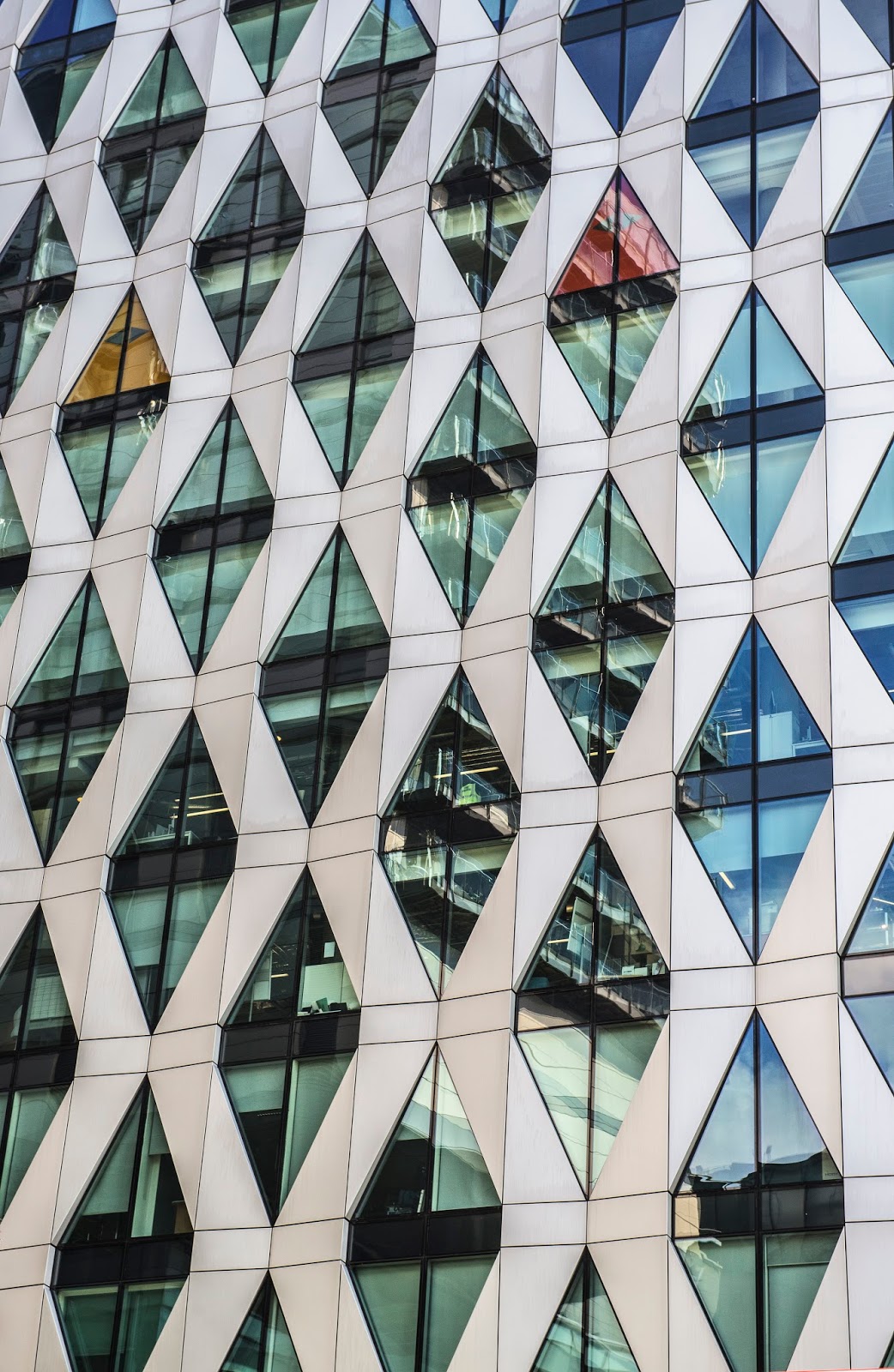
I think the Quays and MediaCityUK are great places to go with the camera. I do love old architecture but I also find a lot of merit in the modern which this area has in abundance. Consequently, in photography terms, it tends to take me out of my comfort zone as I normally deal in landscapes and nature.

I parked up on a four hour ticket and only just got back to the car in time which just go to show how interesting and varied the place is. In that four hours, I included a customary visit to the Costa Coffee Shop who amused me by using an umbrella template to sprinkle the chocolate on the top of my cappuccino. Well I was in Manchester, the home of drizzle!

This entire area was previously the site of the Manchester Docks. Salford Quays became one of the first and largest urban regeneration projects in the United Kingdom following the closure of the dockyards in 1982 and is now home to -
  • The Lowry Theatre and Art Gallery which has a permanent exhibition of  L.S. Lowry's work,
  • MediaCityUK with it's focus on creative industries whose principal tenants are media organisations including the BBC.
  • Imperial War Museum North (IWM North). The museum's structure was designed to be a metaphor for a world shattered by war with sloping walls and ceilings and holds extensive collections of historical artifacts, primarily from the wars occurring during the 20th century. It also currently has a large framework section taken from the New York 9/11 Twin Tower disaster. The last time I was at the museum there was an exhibition on the Iraq war which had the remains of a car detonated by a bomb which was a very sobering and thoughtful sight. 

Added to the above there is a shopping mall (sorry an outlet village) plus a surrounding area of both business and residential properties all offering great photo opportunities. It also has Old Trafford, the home of Manchester United as its next door neighbour. 

The journey over and back  on the M62 and M60 can be a proper pain. No matter what they do to try and improve those roads, just fails miserably. I got stuck in heavy traffic both ways but neither spoilt my enjoyment of the day. I hope you enjoy the photos I took.


The Quays

Bridge over the Quays

Bridge over the Quays

MediaCityUK

MediaCityUK

MediaCityUK

MediaCityUK

MediaCityUK

MediaCityUK

MediaCityUK

MediaCityUK

MediaCityUK

The Quays

Residential Properties Pier 9 (North Wharf)

The Lowry

MediaCityUK

The Lowry

BUPA, Erie Basin (Dock 9)

BUPA, Erie Basin (Dock 9)

Residential Properties Pier 9 (North Wharf)

Salford Quays Panorama

Salford Quays Panorama

Imperial War Museum North

South Tynedale Railway


For an hour of my life I was transferred back to my childhood, a time when the family used to make its yearly pilgrimage, via steam train, to see my mother's relatives in Burton on Trent. The scale of things may have been different in those days; the train being the Devonian Express which ran from Bradford Forster Square Station all the way down to Paignton and the journey a tad longer but the excitement was just the same for both journeys. Me and Sal sat waiting in the carriage like a couple of excited kids and I don't think we were the only ones. There's something about railways like the South Tynedale which takes people back to happier, carefree times when the world seemed to run at half the pace it does today.

Our engine for today was The Naworth. This locomotive formerly worked for National Coal Board, North East Area at Horden Colliery, County Durham and was constructed in 1952 by Hudswell-Clarke & Co. of Leeds. It took a wee bit of time to get it's speed up but then seemed to chug along nicely on the South Tynedale Railways 2 foot gauge track. In fact it reached speedy heights of around 15mph in places!

We had our own Jolly Fat Controller who made sure everything ran like clockwork and who, if there were any children on the train, made sure one of then blew the whistle and waved the green lag to set the wheels in motion. I thought that was a very nice touch. We also had a poor little terrier dog on boardfor our outward journey (see photo below). It couldn't work out what exactly was going on and was quite frightened until the Fat Controller made a fuss of it. It seemed to calm down a bit after that.

The current line is only about three and three quarters of a mile long at present (even though it seemed a lot longer) and stops at two stations: Kirkhaugh and Lintley Halt. An extension has been built to Slaggyford a mile and a half away and, even though the build is complete, it will not be open to the public until Easter 2018. They had hoped to have it open for July this year. There are also ambitious plans afoot to extend the line to its original length and meet up with the main line at Haltwhistle, a distance of over 13 miles. That would be fabulous if they could.

So me and Sal travelled to the end of the line with the intention of following the simple trackside path to Slaggyford and then walk to the next village called Knarburn, have a pint in The Kirkstyle Inn before going back on a later train. I immediately took us off on the wrong path and we somehow finished up on The Pennine way! I had trainers on and the going in places was slippy and muddy so I wasn't really a happy bunny but I have to admit that it was very scenic. Added to that, the walk on the road from Slaggyford was a bit longer than I remembered so this gave me more to grumble about. I have to put my hand up to this gaff though and shouldn't have complained, but I did!

As usual Sal took all this very seriously and proceeded to laugh at me, pull funny faces of me and call me a grumpus for the rest of the day. The pint really touched the spot though and, suitably refreshed, we set of back along the road to Slaggyford. This time we walked up to the station and found the path we should have come up by. If truth be told, it was rather tedious and boring path compared to the Pennine Way path but I thought on this occasion it would be best just to keep my mouth shut! Once back at Lindley Halt, we had about a fifteen minute wait for our train back to Alston but there is a picnic area by the station so this was no hardship.

Despite my grumblings, this was one of the best days out I've had in ages. Mind you, it always helps when your companion is as childish and as nerdy as you are...


Naworth engine

Alston Station

Platform Sign

Platform Sign

Platform Sign

Platform Sign

Platform Sign

Platform Sign

Alston Station

Alston Station

Frightened doggy

Railway carrage

Alston Station

Alston Station

Lindley Halt station

Shut the gate.

Thornhope Burn

Pennine Way nr Slaggyford

Pennine Way nr Slaggyford

River South Tyne from Pennine Way

River South Tyne from Pennine Way

Overgrown bench, Slaggyford

Kirkstyle Inn, Knarsdale

Low Force and High Force

I had a drive over Hartside Pass to Alston and then up to High and Low Force waterfalls back in September. It was a toss up whether I came there or went on the South Tynedale Railway but I decided to leave that one for a day when Sal was up in the Lakes. There had been a fair bit of rain over in the Lake District so I plumped for the waterfalls, hoping they would be plenty of water flowing down the River Tees. Unfortunately most of the rain must have dropped in Cumbria as the waterfalls were a bit of a let down. The two previous times I'd been, they had been very impressive and been in spate.

I parked near Low Force and just walked along the Pennine Way (which follows the river) to the viewpoint overlooking High Force and then back. High Force is always impressive no matter what time of year or whatever the weather is like.

The waterfall is within the North Pennines Area of Outstanding Natural Beauty (AONB) and European Geopark. Despite popular belief that it is the highest waterfall in England, at 71 feet (22 m), others have a longer fall: Cautley Spout, in Cumbria's Howgill Fells, is almost 590 feet (180 m) high, and Hardraw Force, in North Yorkshire, has an unbroken drop of 98 feet (30 m). 

It is still spectacular though and well worth a visit. 


Low Force

Low Force

Low Force

River Tees

Footpath post

High Force

High Force

High Force

Cartmel

It must have been over twenty years since I was last in Cartmel and as you'd expect from this sleepy corner of Cumbria, the place hadn't changed one bit. Oh I tell a lie, a large tree has grown by the bridge over the river which now obliterates the very photogenic view of the church but that is about all. The roads are just as narrow and aren't really suitable for the coaches which bring in the many visitors. I had a fight with one on the lane leading to the race course which is the main at park. All I could do was tuck in, fold in my wing mirror and pray! God knows what its like on race weekends.

I was with Sal and we had intended to visit Grange over Sands as well but we spent longer than expected in Cartmel. Our first port of call was The Sticky Toffee Pudding Café with the sole intention of just having a coffee but once we saw that they had warm Morecambe Bay Potted Shrimps on the menu... well it would have been rude not to. They were served with brown toast and a green salad and were absolutely delicious.

The main attraction in the village is the Priory church which has a long and turbulent history. It dates back to 1190 and was founded by William Marshall the 1st Earl of Pembroke and was dedicated to Saint Mary the Virgin and Saint Michael. Then came the Dissolution of the Monasteries in 1536 by Henry VIII. The Dissolution commissioners had instructions to "pull down to the ground all the walls of the churches, stepulls, cloysters, fraterys, dorters, chapter howsys" and all the rest. The materials were then to be sold for the profit of the Crown. These habitual procedures would have meant Cartmel Priory's church being demolished along with the rest of its buildings.

However, in this case the founder William Marshal had given an altar within the church to the village, and provided a priest along with it. The villagers petitioned to be allowed to keep the church as it was their only place of worship, and this was granted. In 1643 some Roundhead troops stayed in the village, stabling their horses in the church and bullet holes from this time are still visible in the southwest door of the nave. Over the years the place has also been used as a prison and a grammar school.

Then, after our visit to the priory and both armed with our cameras, we had a very enjoyable wander around the village. I think the highlight of Sal's afternoon was seeing a sign outside the Village Hall for a Mother's Union exhibition. The spelling of exhibition was spelt wrong on both sides and the apostrophe grammar was all over the place. Sal is not known as a spelling and grammar nerd for nothing! The sign in question is the final photo of the blog.

The weather gods were on our side that day because the rain which had been promised all day, only arrived on our drive back. Unfortunately this resulted in us not calling for our daily pint.


The Market Square

Sticky Toffee Pudding Shop

Ornate sign above doorway

Ironwork Bench

The Market Square

Cartmel

Old bicycle sign

The River Eea

Cartmel

The River Eea

Cartmel Priory

Old Street Lamp

Exhibition Sign

Tarn Hows

Tarn Hows, which is a man made lake, was developed from three smaller tarns - which were known as High Tarn, Low Tarn and Middle Tarn. The s...