The uppermost course of the River Wharfe runs through Langstrothdale, but Wharfedale does not begin until the Wharfe meets Cray Gill, downstream of Hubberholme. The name Langstrothdale derives from Old English and translates as 'long marsh' or 'marshy ground'.
The dale was first colonised by Anglians in the seventh century, with Norse invaders arriving later. In Norman times, many of the isolated settlements were allowed to remain, but were prevented from expanding by an arcane ruling known as the 'Forest Law'. At that time, Langstrothdale was well forested, and the upper northern part of the dale (which is now moorland) was a royal hunting forest known as Langstrothdale Chase or as the 'Forest of Langstroth'.
The dale became part of the lands owned by the Clifford family and in 1604, due to the then Earl of Cumberland's 'extravagances', the lands were sold to pay off his debts. This allowed many Dales folk to purchase their own farmsteads.
Also, in the age before mass transportation, the road through the dale was part of a packhorse route from Lancaster to Newcastle upon Tyne.
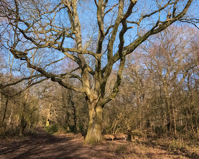
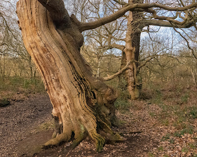
My visit started off in quite nice weather but, as can be seen from the photos, it quickly deteriorated and the rain moved in, but not before I managed to walk part of the valley and take some photos. I love all the old beech trees which are scatter along the river bank as they do lend themselves to good photography compositions but I'm afraid disease is spreading amongst them which is resulting in a lot dying.
It's nice to be out and about in this area in any sort of weather though and a bit of rain never hurt anyone.
 |
| Yockenthwaite |
 |
| Yockenthwaite |
 |
| Hillside Tree |
 |
| Hillside Tree |
 |
| River Wharfe |
 |
| River Wharfe |
 |
| River Wharfe |
River Wharfe |
| River Wharfe |
 |
| River Wharfe |
 |
| River Wharfe |
 |
| River Wharfe |
 |
| River Wharfe |
 |
| River Wharfe |
 |
| River Wharfe |
 |
| River Wharfe |
 |
| River Wharfe |
 |
| River Wharfe |
 |
| River Wharfe |
 |
| River Wharfe |