Hawswater Dam

Not much narrative for this blog, it's just a series of photos which show how low the water level has sunk due to the hot and dry June and July we had this year. I'm led to believe about a month or so ago, the level was so low that parts of the settlements and roads (which were flooded when Manchester Council constructed the dam) could clearly be seen.

The dam was considered to be an engineering feat in its time. The creation of a reservoir in the Haweswater area was first looked at by a Royal Commission in 1866. Fifty years later in 1919 an Act of Parliament enabled the development of Haweswater beck into a reservoir with a capacity 85,000 million litres. Construction started in 1929 on the dam however it was abandoned for three years between 1931 and 1934. Once complete the reservoir took almost a year to fill with the first recorded water overtopping and flowing down the overflow slipway in 1941.

One of the major hurdles to the building of a reservoir in the Haweswater Valley was the village of Mardale. Before the water levels could rise the villagers were moved out and their homes and other buildings dismantled. At the centre of village life is the church. Bodies buried in the graveyard were exhumed and many reburied at Shap. One of the major hurdles to the building of a reservoir in the Haweswater Valley was the village of Mardale. Before the water levels could rise the villagers were moved out and their homes and other buildings dismantled. At the centre of village life is the church. Bodies buried in the graveyard were exhumed and many reburied at Shap. Windows and some of the stones from the church were reused in the draw-off tower situated a little way back from the dam wall. Two hundred men worked on the construction of the dam. They lived in a temporary village called Burnbanks, with their families which was built nearby.

 Nature seems to eventually get its own back though and, as we have seen during an occasionally wet August, the rain will top it back up to its former level over the coming winter months.

Riggindale and High Street

Riggindale and High Street

Harter Fell

Riggindale and High Street

Harter Fell

Sunken Lane

Maredale Head

Low Water Level

Kidsty Pike

Low shoreline

The Rigg and Wood Howe Isle with Kidsty Pike behind

Wood Howe Isle

Rowantreethwaite Beck, Haweswater

Rowantreethwaite Beck, Haweswater

Rowantreethwaite Beck, Haweswater

Taking Lady Anne Clifford's Way up to the Lakes.

Maybe not the usual way for getting up to the Lakes but it was a Bank Holiday Saturday and, by the time I had reached Settle, I was sick and tired of the A65. Farm vehicles were the main culprits with one holding up the traffic from just outside of Skipton until it turned off a mile or so before Hellifield. The cars behind weren't prepared to overtake so an ever increasing queue of frustrated drivers formed.

I had some shopping to do so I turned off at Settle and then followed the Horton in Ribblesdale road as far as the Ribblehead Viaduct. This was the only busy place of my drive. No matter how much roadside parking spaces they develop, there is still not enough especially at weekends and, with this being a Bank Holiday weekend, boy was it busy.

I took to the Hawes road and, after a couple of miles, I headed down in to Dentdale and past the Dent Head Viaduct. No matter how many times I go on this road, I have to stop and take a photo of the viaduct. The viaduct sits perfectly in the wooded v-shaped valley and is looked down upon by rough and uncompromising wild moorland with high fells beyond.

I then followed the Old Coal Road past Dent Station to Garsdale Head and then on to Kirkby Stephen via Mallerstang. The Old Coal Road's name comes from back in the mining days when the area had extensive coal workings which lay on the moorland either side of the road. These coal pits were worked by local people, initially to produce domestic fuel, but by the 18th century, the poor quality coal was also being used in lime kilns. Commercial coal mining went on in Garsdale until the 1870s when the Settle-Carlisle railway started bringing in cheaper, higher quality coal from the Lancashire and West Yorkshire coalfields.

The highlight of Mallerstang is the ruins of Pendragon Castle which is reputed to have been founded by Uther Pendragon, the father of King Arthur. According to legend, Uther Pendragon and a hundred of his men were killed here when the Saxon invaders poisoned their well. There are also claims that the Romans built at least a temporary fort here, along the road between their forts at Brough and Bainbridge but, apart from legend and supposition, there is no real evidence that there was any building here before the Normans built their castle in the 12th Century.

It was built next to the River Eden in the late 12th century, probably by Hugh de Morville and, like the nearby castles of Appleby and Brough, Pendragon came into the possession of the Clifford family. It was abandoned after a raiding Scottish army set fire to the castle in 1341, but was rebuilt in 1360. It was left in ruins by another fire in 1541, but was restored in the mid 17th century by Lady Anne Clifford. The castle gradually fell back into ruin after her death and now remains a romantic ruin set in stunning scenery.

Lady Anne Clifford's Way is a long distance footpath which takes in five of the Clifford families ruinous castles: these include Skipton, Pendragon, Appleby, Brough and Brougham Castles. At the age of 60, she spent the next 26 years of her life restoring the mostly ruinous family castles to their former glory. Some woman eh?

After Kirkby Stephen it was then on to the A66 (which fortunately wasn't too busy), passing Appleby, Brough and Brougham Castles and then through Penrith before arriving in the Lakes. It may have been a few miles longer than my normal drive but it was much more enjoyable and certainly more interesting to read about!

Dent Head

Dent Head Viaduct

Above Dentdale

Wild Boar Fell

Mallerstang

The Old Coal Road

Wild Boar Fell

Rose Bay Willow Herb

Pendragon Castle, Mallerstang

Pendragon Castle, Mallerstang


Pendragon Castle, Mallerstang


Mallerstang


Coffee and cake in Greystoke (with a walk thrown in for good measure).


Another blog from my recent holiday with Sal. The forecast wasn't too good so we didn't fancy travelling very far. Greystoke is only a couple of miles down the road and has a lovely looking cafe for the post walk nibbles, so it fit the bill perfectly. There are no public footpaths around the estate but there are permitted footpaths which the owners and the local council have made easy to follow by numbering each noticeable feature. To go with that, there is also an online map with comprehensive detail so it is more or less impossible to get lost.

However not long in to the walk we did go slightly astray for which I blame my guide but we did realise it pretty quickly. The walk itself is about eight miles if you do the full circuit but the drizzle started and was blowing directly in to our faces so we decided to cut it short at the point where we reached open moorland which, if truth be known was only a couple of miles in to the walk.

Just before we did our about turn we passed a woodland full of pheasants (which the estate uses to shoot for so-called pleasure). We startled them and they startled us as well. About fifty of them flew from their cover and amusingly started running up a track to get away from us. It reminded me of a scene from a Benny Hill show, all that was missing was the music! I'm sorry but I just can't understand what pleasure anyone would get out of shooting a live animal just for the fun of it. People who do that really appall me and, as far as I'm concerned, it can't be justified in any way shape or form.

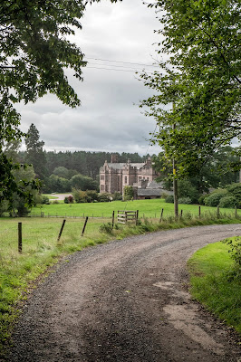
The return walk wasn't too bad as the wind was now behind us and the drizzle finally eased off as we approached the Castle. Its a shame you can't visit the Castle's grounds because, looking on the Internet, there appears to be some nice gardens and lakes surrounding it but it is a private dwelling though. I suppose people are entitled to have their privacy and a least they have allowed and maintained permitted footpaths for the general public to use.

We ended our afternoon with a coffee and a piece of cake each at the C2C Cycle Cafe on the edge of the village.The Cycle Cafe consists of a pretty walled Tea Garden with gazebos, along with a rustic barn for shelter if the weather is inclement. During quiet periods only the barn is open and this is  operated purely on a self service basis with drinks and cakes to hand. I suppose they rely on the honesty of their customers for payment and let's face it, you would have to be a pretty mean spirited individual not to pay. It is another cafe which is run by local people and their baking is divine. Sal had a piece of tiffin and I had one of the scrummiest slices of lemon drizzle cakes that I've ever had. The baking is definitely up to what I would call "Women's Institute standard" which, in my book, is bloody good!

This is another walk for us to do on a fine day: a day when we can take our time and do the complete 8 mile circuit.

To end the blog, here is a brief history of the castle -
  • In 1069, Llyulph de Greystoke, after whom Ullswater is named, was re-granted his lands by the Normans, following their successful conquest. The wooden tower he had built at Greystoke, which was surrounded by a high fence or pale (pele), was replaced with a stone-built tower.
  • In 1346, King Edward III gave permission for the building to be castellated and the castle proper was created.
  • Thomas Howard, Duke of Norfolk and Earl Marshal of England, sent north in the early 1520s to solve the Scottish problem, met and subsequently married Lady Anne Dacre. She had inherited the castle and lands on the death of her husband and her marriage gained for the Howard family a considerable part of what was the county of Cumberland.
  • The castle became one of the border chain of fortifications which replaced Hadrian’s Wall as a barrier against the Scots.
  • The castle was held for the King during the civil war and after the war, in 1660, was destroyed by Cromwell as a result. The castle was later rebuilt and enlarged into a modern farm.
  • In 1868, a maid left a lighted candle in a cupboard full of linen and the consequent fire destroyed large parts of the castle. It was rebuilt by Henry Howard.
  • The estate was commandeered by the army in 1939 and the land became a tank-drivers’ training ground. The castle itself later became a prisoner of war camp, largely for Poles who had been fighting for the Germans, the prisoners providing labour to run local farms whose men-folk were away fighting.
  • Post-war, the long process of restoration and modernisation was initiated which has continued ever since. Fourteen generations of the Howard family have lived in the castle thus far.


Exercising the local racehorses

Greystoke Village Cross

Sal at the Castle Entrance

Main Castle Driveway

Greystoke Castle

Greystoke Castle

Home Farm

Tractor Collection

Castle Pond

Dutch Barn

Dutch Barn

Disturbing the local game

Home Farm

A wet Home Farm

Straw in barn

Home Farm

Pele Tower, Greystoke Castle

Castle Grounds

Driveway up to the Castle

Beware, Red Sqirrels

Castle and Pele Tower

Old Castle Entrance

Lanercost Priory

Two visits to Lanercost within a week, the first with my sister and the second with Sal. I'm using the photos from my first visit and the narrative from my second!

I love visiting old Churches, especially in the Dales and Cumbria because they are so quiet and peaceful inside and are seeped in history. Lanercost is no exception with it sitting in the tranquil valley of the River Irthing. The Augustinian Priory was founded around 1166 by Robert de Vaux and was built mostly from stone taken from nearby Hadrian's Wall. It was completed in 1220.

The Priory has quite a violent history due to it being located so close to the Scottish border. Edward I stayed here three times (1280, 1300, 1306) when he conducted raids against the Scots and on the last occasion, when he fell ill, he stayed the winter at the abbey. The Scots set fire to the cloister in 1296 and two famous Scots, William Wallace and Robert the Bruce also attacked the priory. Raids continued well into the 14th century when, unfortunately, bills for repairs needed more money than they had available which meant that the land had to be sold to cover the costs.

Lanercost was one of the first priories dissolved by Henry VIII. He gave the buildings and the land to Sir Thomas, Lord Dacre, the illegitimate son of Lord Dacre of Naworth who's castle is nearby. He turned part of the Priory into a country mansion called Dacre Hall, and started residing there in 1559. Unfortunately the priory then fell in to ruin once the male line of the family had all passed away.

The ruins are approached through an archway which was once the gatehouse. Remains of parts of the north and south transepts, choir, sanctuary, cloister, chapter house, and undercroft still survive. The chapels are home to some very striking tombs. These include the imposing tomb of Sir Humphrey Dacre, who died in 1485, and his wife Lady Mabel. Rather more recent is the tomb of Charles Howard, 10th Earl of Carlisle, designed by the architect Robert Lorimer and placed here following the Earl's death in 1912. But without doubt the most poignant memorial is a life size terracotta effigy of Elizabeth Dacre Howard, who died on 17 July 1883 at the age of just four months.

The Priory Church of St Mary Magdalene has an unusual medieval stone carving called the Lanercost Cross with an inscription dating back to 1214. Originally the cross was set just outside the entrance to the church and the stump still remains there but the main shaft is now housed inside the priory. 

Our visit there started off with a coffee in the excellent cafe. We had to use lots of will power to resist having either a bacon sandwich or one of the scrummy cakes they sell. It is one of those cafes, or should I say tearooms, which is run by the local community and they inevitably turn out to be the best and friendliest. Justifiably so, it is quite busy as it is a convenient "stop off" for people visiting Hadrian's Wall country.

After our coffee break we took a short stroll around the Priory's graveyard and then walked across to the River Irthing where we were lucky enough to see a heron. We followed the riverbank to the old Lanercost Bridge before returning via the road to the car park. I will have to check my OS maps before our next visit so that we can extend our walk and take in more of the surrounding countryside.

Over the years I have come to love this part of the country because it is so varied. On the one hand you have the peace and tranquillity of the Lanercost and Brampton area which, only a few miles away, is contrasted by the stark wilderness of Hadrian's Wall and the large, open expanse of Northumberland.

The Lakes weather forecast hadn't been very good and it was the height of the holiday season so our escape plan (not that we needed a plan) worked perfectly.


Dacre Hall

Leaded Window 

Priory Ruins

The Undercroft

Pear tree

The Chapel and Alter 

Effigy of Elizabeth Dacre Howard

Priory Wall

The Alter

Pear Tree and Ruins

Dacre Hall

Balmacara and Skye

 WE had a mixed week of weather but on the whole we managed to stay dry. The only wet day was our second day when Sal stayed in the cottage ...